
Henrietta Neighbors by Parcel
For this purpose, a neighbor is an adjacent parcel polygon, not a presumed social relationship. A parcel map can show which lots touch the target lot. An assessment roll can show a dated tax-record owner and mailing field. A voter record may only be reached through its controlled, person-specific or statutory route. Civic pages identify organizations, not the people who belong to them. Keep those sources separate when looking at Henrietta neighbors.
| Source | What It Shows About a Block | Access |
|---|---|---|
| County Parcel Viewer | Adjacent polygons, addresses, municipality, and map context | Public map tools; preserve map date |
| Assessment roll | Tax-roll owner, mailing field, class, and roll date for a parcel | County or town assessment route |
| Subdivision plat | Lot, block, street, plat/liber-page, and planned parcel structure | Find the actual recorded plat |
| Annual voter list | Statutory election-district street or alphabetical arrangement | Controlled distribution; dated election record |
| Civic organization page | Public institution names and contact paths | Not a member roster |
An owner is not necessarily an occupant. A mailing address is not a legal municipality. The map and roll are useful only when their date and role travel with the result.
Henrietta Neighbor Map Process
The County Parcel Viewer provides Address Search, TaxIDSearch, identify-polygon, print/report/share, and BufferParcel tools. Use the buffer only to discover possible nearby parcels. It is not a legal boundary survey, and a buffer can include a road, easement, or a polygon that does not actually abut the target. Manual review of each polygon is what makes the result an adjacent-parcel result.
- Search the target address or tax ID and record the displayed parcel ID, address, and municipality before opening nearby parcels.
- Identify the target polygon, then inspect each polygon that visibly touches its boundary. Exclude roads, easements, and noncontiguous parcels.
- Record each adjacent parcel ID and address separately. If an owner or mailing field appears, label it as an assessment record and retain the roll date.
- Save the map URL or dated screenshot and note the geometry layer. For a whole named street rather than an immediate block, use the Henrietta street address directory.
The output should say that adjacency was spatially observed. It should not add phone numbers, dates of birth, unverified occupants, or inferred relationships.
Henrietta Parcel Update Cadence
Map dates matter around a Henrietta block. The public parcel feature layer uses polygon geometry and has daily assessment joins, a weekly parcel-layer recreation, and quarterly distribution. A GIS display and a final assessment roll can therefore be out of sync. Save the displayed map date, the assessment-roll date, and the retrieval date instead of describing a parcel result as timeless.
The public feature layer displays the parcel-address street name and is built for spatial review, not a legal boundary survey. Print, report, or share controls can preserve a dated map view, but the saved view should identify the target parcel and the geometry layer used. If an assessment field changes before the recreated parcel layer is distributed, leave that timing difference visible rather than treating the two sources as conflicting names or addresses.
The map also carries town and village boundaries, ZIP boundaries, centerlines, and basemap features such as roads, rail, water, buildings, and parks. Those layers help explain why a visually close parcel may not be an adjacent parcel. A town neighborhood-code map is planning geography, not a ZIP, election district, or household group. The town maps are useful for that separate planning context.
Note: A current map is a dated spatial observation, while the assessment roll is a separate dated tax record.
Henrietta Voter-List Boundaries
New York’s annual voter list may be arranged by election district and by street and number or alphabetically. That does not mean the County or State interactive lookup offers a one-click list of nearby registrants. The Monroe tool is person-specific and asks for Street #, Street Name, ZIP, Last Name, and Date of Birth. The state tool uses county, name, date of birth, ZIP, and address information for a registered voter’s own search context.
Election Law §3-220 makes registration records public under Board supervision while excluding DMV license or ID data, Social Security information, and facsimile signatures. A state voter-file request must state an elections purpose under Election Law §3-103(5). For an annual-list or file question, identify the election year, geography or district, format, and lawful elections purpose with the Board. Do not scrape or republish nearby names from a block search.
Status is not a move detector. A status may change through address confirmation, a voter response, cancellation, death information, or Board maintenance, and the live screen may not show the event history.
Henrietta Civic Contact Map
Henrietta’s official community page is a civic-contact inventory, not a directory of people. It names organizations that can help someone find a public meeting, activity, or general contact route. It does not publish member rosters, association boundaries, or a verified neighborhood-association list. Do not infer membership from an address, a business filing, or event attendance.
| Public civic organization | Contact path | What is not published |
|---|---|---|
| Henrietta Chamber of Commerce | Town community-organization listing | Member household roster |
| Henrietta Historical Society | Town community-organization listing | Member roster |
| Ely-Fagan American Legion Post 1151 | Town community-organization listing | Member roster |
| Henrietta Garden Club | Town community-organization listing | Member roster |
| Henrietta Fire District | Town community-organization listing | Resident or member directory |
| Henrietta Community Foundation | Town community-organization listing | Member roster |
| Rush-Henrietta Rotary | Town community-organization listing | Member roster |
The Henrietta document library supports an address-to-record search through its department, category, and file-name filters.
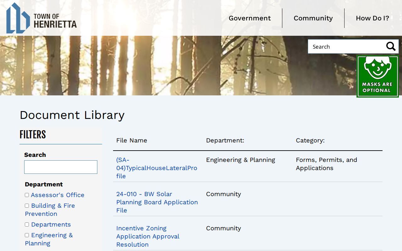
Search a precise department or file category for a public municipal record, then keep any applicant, permittee, or meeting-attendee role distinct from an address resident.
Henrietta Neighbor Address Quirk
Postal labels can make a nearby Henrietta parcel look as though it belongs to another place. Official records use Henrietta 14467, West Henrietta 14586, and Rochester 14623, while the Town Historian’s Tinker Homestead uses Pittsford 14534. Town Hall has a Rochester 14623 postal line but is in the Town of Henrietta. A street or parcel result should therefore carry the raw postal line and legal municipality separately.
The practical address sequence is raw string, standardized street form, postal city and ZIP, municipality/SWIS, parcel ID, and roll or map date. A ZIP polygon is a mail-geography layer, not a municipal boundary. When a street crosses an edge, split the block results by legal municipality before comparing parcels. The town’s Assessor controls final address assignment, which is another reason to retain the exact numbered address rather than normalize it by guesswork.
Henrietta Neighbor Source Comparison
Official and commercial categories do different things. A dated parcel map, assessment roll, or controlled election record identifies its custodian and record role. A commercial neighbor-lookup category may combine public filings, licensed datasets, and user-submitted or stale material, may charge for access, and can conflate same-name people or old addresses. It is not a replacement for a current, role-labeled public source.
| Source category | Best use | Limit to keep visible |
|---|---|---|
| Official GIS and assessment records | Dated parcel geography and tax-record ownership context | They do not prove who occupies a parcel. |
| Controlled election records | Individual election context or a dated statutory list | Board supervision, privacy exclusions, and purpose rules apply. |
| Historical directories and plats | Period-specific printed or planned address context | Coverage gaps and past dates must be kept visible. |
| Commercial neighbor-lookup category | Potential lead only | May combine stale or mismatched data and lacks a custodian-specific role. |
Use the official source’s date and explanation first, then seek a second independent record if a name-address match matters.
Henrietta Neighbor Privacy
Public parcel adjacency does not open a private household graph. Household members, unverified occupants, utility customers, delivery information, phone numbers, and dates of birth sit outside this block workflow. New York’s Address Confidentiality Program provides a substitute address and mail forwarding for qualifying participants. Do not try to reverse or geolocate a substitute address. DMV personal information is also protected and is not a neighbors source.
A public address or record is not permission to contact, follow, track, or monitor anyone. New York stalking and harassment laws apply even when a detail came from a lawful source. If an official record appears wrong, contact its custodian with the map date, parcel or index number, and source details rather than editing or redistributing the record.
Lawful use. Use Henrietta neighbors records for personal, lawful block research and civic context. Never use them to stalk, harass, intimidate, or harm a person.
Henrietta Neighbor Record Labels
Use precise labels for the final block notes: target parcel, adjacent parcel, spatially observed adjacency, tax-roll owner, historical directory occupant, planned lot or block, civic institution, and retrieval date. Those labels prevent a parcel boundary from becoming an unsupported claim about relationships or current living arrangements.
A subdivision plat is useful when a numbered address did not yet exist. Its lot, block, street, adjacent-owner or subdivision name, utilities, and liber/page fields describe planned parcel structure. Keep that planned layer apart from a modern GIS polygon and from an assessment record. A historical directory can add a printed address and date, but its coverage may be incomplete. For a block history, compare the plat, a deed or assessment record, a dated directory entry, and a current map snapshot without collapsing their distinct roles.
When the map, roll, and address label disagree, keep the conflict visible. Check the exact address in GIS, preserve the roll date, and ask the responsible office about a specific record. Clear limits make a Henrietta neighbors result more useful than an unqualified list of names.